
How a Putnam County Property Search Moves Between Records
The WV Property Assessment Search is the most detailed public entry point for Putnam County records. It offers Basic, Appraisal/Sales, Advanced, and Prior Ownership modes. Set County to Putnam first. Then add a street name, owner, or parcel key. Once a result appears, copy the Root Parcel ID, district, map, parcel, deed book/page, and legal description before you switch to another office.
- Choose Putnam County and search by property address, street, owner name, or the full parcel ID.
- Record Current Owner, Root Parcel ID, property address, district, map, parcel, deeded acres, and the deed reference.
- Use the owner or parcel key in the Putnam County Clerk’s RECORDhub land index to locate the conveyance.
- Compare the parcel in the WV Property Viewer and use the Sheriff portal for tax bill or receipt details.
- Request a Clerk copy or custodian inspection when an image, older deed book, plat, or permit is not online.
Putnam County Property Search Fields in the Assessment Portal
A Putnam County property search in the assessment portal starts with its four modes. Basic handles quick lookups. Appraisal/Sales, Advanced, and Prior Ownership dig deeper. Most fields are optional. County and district help when a name or street is broad. Some dropdown choices stay hidden until opened. The sale-price field is not documented, so compare returned rows with care.
| Field label | Type | Required | Options or format notes |
|---|---|---|---|
| County | Dropdown | No | Choose Putnam to narrow results. |
| District | Dropdown | No | Includes rural and corporate districts such as Hurricane Corp and Winfield Corp. |
| Full Parcel ID | Text | No | Enter the full statewide identifier when available. |
| Owner Name | Text | No | Current-owner search; LLC and organization names appear in results. |
| Map Number | Text | No | May include a letter, for example 223G or 204G. |
| Property Class | Dropdown | No | All options were not exposed. |
| Street Name | Text | No | Search by a road name; partial-match rules were not stated. |
| Parcel | Text | No | Parcel component from the local map scheme. |
| Tax Class | Dropdown | No | All options were not exposed. |
| Sub-Parcel | Text | No | Use when the tax record has a subparcel. |
| Land Use | Dropdown | No | All code options were not exposed. |
| Min/Max Land Appr | Numeric range | No | Appraised land value. |
| Min/Max Building Appr | Numeric range | No | Appraised building value. |
| Min/Max Calc Acres | Numeric range | No | GIS acreage estimate, not deed acreage. |
| Sale From/Through | Date range | No | Available in Appraisal/Sales mode. |
| Min/Max Total Appr | Numeric range | No | Total appraisal filter. |
| Min/Max Price | Numeric range | No | Sale-price filter; exact field meaning should be verified. |
| Min/Max Deeded Acres | Numeric range | No | Deed-reported acreage filter. |
| Flood Hazard | Dropdown | No | Flood filter; choices were not fully rendered. |
| Mailing Address | Text | No | Separate from the property address. |
| Deed Book / Page | Paired text fields | No | Recorder cross-reference. |
| Legal Description | Text | No | Lot, tract, or metes-and-bounds text. |
| Building Year Min/Max | Numeric range | No | Structure-age filter. |
| Primary Structures Min/Max | Numeric range | No | Primary structure count. |
| Building Area Min/Max | Numeric range | No | Building-area filter. |
| Secondary Structures Min/Max | Numeric range | No | Secondary structure count. |
| Lines per page | Display control | No | Sets result-page size. |
| Display legal description | Checkbox | No | Adds legal text to result rows. |
| Display GIS parcel ID | Checkbox | No | Adds the GIS identifier to results. |
The portal exports CSV results. It also paginates long sets and links out to the WV Property Viewer. Those controls handle broad searches. A parcel split or a renamed street can still make an older key behave differently. The official WV Property Assessment Search is the source for current search controls.
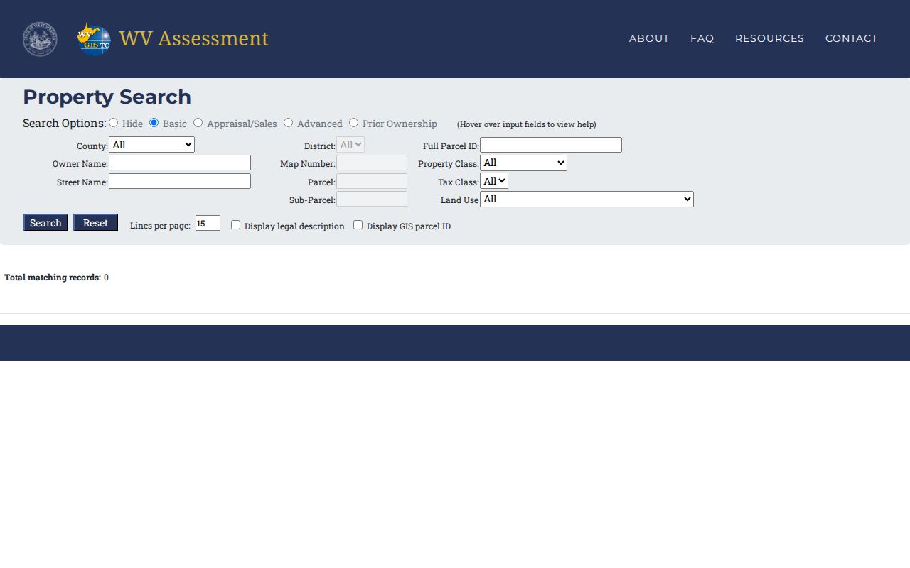
The screenshot shows the search interface rather than a deed or certified parcel card.
Putnam County Property Search Results Show the Current Owner Field
An owner query for Putnam County returns a wide result set. One search brought back 111 records across eight pages. It included fifteen visible columns and a CSV Results link. Each row can show Root Parcel ID, Current Owner, Property Address, County, District, Map, Parcel, Map Link, Flood Tool, Deeded Acres, Property Class, Land Use Code, and Tax Class. It can also show Building Appraisal, Land Appraisal, and Total Appraisal. A blank address is no reason to discard a row. Neither is a lettered map. Save the full parcel identifier and compare the legal description before trusting a match.
One sample shows 3967 Teays Valley Road. The owner is the Putnam County Board of Education. The district reads 6-Hurricane Corp, map 40, parcel 70.0, with 11.41 deeded acres. Land and building appraisals sit in separate fields. The total appraisal stands beside them. But these figures describe the assessment record, not the latest closing or market value.
The Putnam result set shows the row layout and pagination.
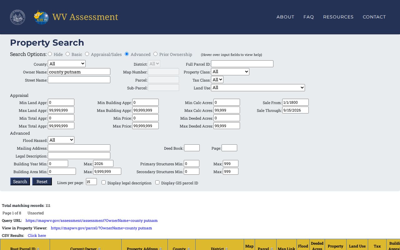
A row is only a starting point. Carry the parcel into the Clerk's deed index or the GIS map, then confirm any newer event with the custodian who recorded it.
What the Putnam County Property Search Row Shows
The assessment row carries more than a name. It ties the tax owner to a district and parcel map. Land and building appraisals appear separately. A deed reference or legal-description display may ride along. Use the owner field to find the tax roll entry. The deed image confirms the conveyance.
| Current Owner | Owner name carried on the assessment roll; it can lag a newer deed. |
|---|---|
| Property and Mailing Address | Property Address is the situs; Mailing Address is a separate searchable field. |
| Root Parcel ID | Long tax key beginning with Putnam’s county code 40 in the inspected rows. |
| District, Map, Parcel | Includes district labels such as 6-Hurricane Corp and 13-Winfield Corp. |
| Deeded Acres | Deed-based area; the state FAQ gives it priority over calculated GIS acres. |
| Appraisal fields | Building Appraisal, Land Appraisal, and Total Appraisal; not a guaranteed sale price. |
The row is not a live closing notice. It is also not a title opinion, survey, or sale appraisal. The Viewer updates annually with new assessment information, and the Sheriff holds July 1 as the date that freezes the next year's name, address, and value. Check the latest deed when a transfer is recent.
Putnam County Property Search Keeps Situs and Mailing Addresses Apart
Two address fields do different jobs in a Putnam County property search. Property Address marks the parcel's physical location. Mailing Address is a separate search field. A tax bill may travel to a trust, a company, or a person far away, so a mismatch alone does not signal a bad parcel. The county's 911 Mapping and Addressing office finished a countywide readdressing by mid-2014 and maintains the system today. An older deed may cite a former road number. Keep both wordings as search clues. Rural tracts can show a blank property address. There, lean on district, map, parcel, deed book/page, or a legal-description fragment. Municipality ZIP codes are postal geography, not city limits, so one ZIP can hold a city core and surrounding county parcels.
- Situs address
- The physical address associated with the parcel.
- Mailing address
- The address used for tax mail, which may be outside the county or held by an entity.
- Parcel ID
- The tax-map key used to connect assessment and GIS records.
- Owner of record
- The owner name shown by a particular record system as of its update cycle.
Putnam County Property Search Risks in a Hurricane LLC Query
A location word can mislead your search. Take the query "hurricane wv." It returns organization names on Teays Valley Road and entries in both 6-Hurricane Corp and 10-Scott District. So a place name is not a district filter. Search the name or street, then read the County and District fields before assuming the parcel sits inside the incorporated city. For an LLC result, copy the exact name into the West Virginia Secretary of State organization search. The County Clerk's deed connects entity and land. The row shows land and building appraisals separately. It can guide a permit-history request. It might also point you to a map lookup, but it will not hand you a complete city permit record or a settled boundary. The Hurricane-area assessment query offers a local example of the city, district, and owner distinctions at work.
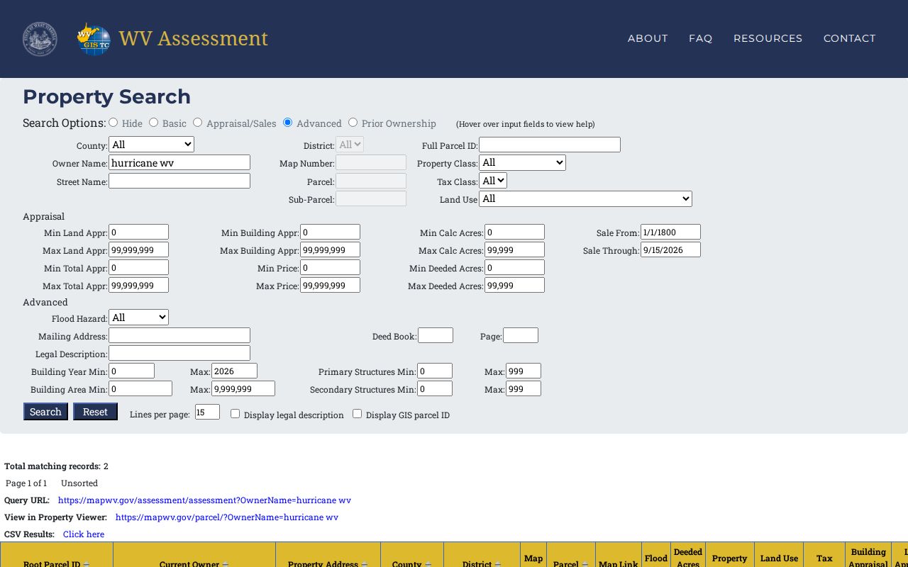
Treat the example as a starting point. Confirm the exact parcel and legal description with the office of record before acting on the result.
Putnam County Property Search Parcel IDs Bridge Assessment and GIS
A West Virginia parcel identifier stitches together several parts: county, district, map, parcel prefix, parcel suffix, and a special ID. Putnam County carries the code 40. The GIS identifier leaves out the special ID. The CAMA/IAS version drops the county code instead. Abbreviated forms may also shed leading zeroes or spaces, so a map label that looks trimmed can still point to the same tax tract. Compare the components piece by piece rather than judging length by eye.
Without the long ID, a district paired with a map and parcel number can still steer the search. Map numbers sometimes contain letters. Parcel values may carry decimal suffixes. When a lot split has redrawn the parcel, the older deed book/page and the recorded legal description become the paper bridge between old and new. The Putnam County parcel-map guide shows how the GIS viewer lines up with those map labels.
Putnam County Property Search Ends at the Deed Index Handoff
Start the Putnam County property search in the assessment portal. That lookup surfaces a likely owner of record, the address, the parcel key, and a deed reference. The reference is only a lead. The recorded conveyance itself requires the County Clerk's current RECORDhub index. Carry the grantee name and parcel description there. The gateway confirms Putnam has moved off the legacy WV Portal. The Clerk's current process governs search availability and image access.
The deed trail can hold many instruments. Examples include a deed with consideration, a deed without consideration, a deed of trust, a plat, a lien, a release, a living trust, a lis pendens, a right-of-way paper, or a trustee report. For a deeper chain of title, the fee schedule, or copy instructions, follow the Putnam County deed records route. The assessment reference alone never substitutes for the instrument itself.
Putnam County Property Search Prior Ownership Mode Has a Coverage Gap
The assessment page offers a Prior Ownership tab. Its search fields, result range, and year coverage stay unclear from the public screen. Treat it as a prompt, not a substitute. It can flag that the current tax roll name changed. An earlier owner of record still needs confirmation. Use a recorded deed or a clerk index/book entry for that.
For a broad owner query, paginate through the results. Use the CSV Results link to save what the public roll returned. The sample query produced eight pages and was marked unsorted. Record your filters. Do not mistake the first screen for the complete list. A second search by full parcel ID can catch a row that a name variation misses. The same goes for a search by legal description.
Compare Address, Owner, and Parcel in the Putnam County Property Search
The best key depends on how solid your starting information is. An address is easy to recognize. An owner name can surface several holdings at once. A full parcel ID is the closest thing to a shared key across the assessment, GIS map, and deed record systems, which is why it anchors most Putnam County searches.
| Search Key | Best For | Where It Works | Watch Out |
|---|---|---|---|
| Address or street | Locate a known property or road corridor | Assessment search and WV Property Viewer | Rural parcels may lack a street number; old addresses can differ after readdressing. |
| Owner name | Find several parcels or start with an entity | Assessment search; then SOS and Clerk index as needed | Names, punctuation, trusts, and estate labels can vary. |
| Full parcel ID | Match one tax tract across systems | Assessment, GIS, and deed cross-references | Systems may abbreviate or omit parts; retain the long ID. |
Not a title search. A Putnam County search points to filed records but does not determine whether title is clear. Use the recorded deed for the conveyance and a title professional for a full title conclusion.