
Putnam County Parcel Maps and Their Layers
The WV Property Viewer displays parcels three ways. Its modes cover parcel, address, and flood zone. Selecting a parcel opens a card with the description, Property Owner, physical and E-911 addresses, building information, cost and appraised values, flood information, delinquent status, external links, and a parcel assessment report. Controls for Details, Highlight, Copy Link, and Download KMZ sit alongside it. These tools help navigation and record matching, not title proof.
| Layer | What It Shows | Use |
|---|---|---|
| Parcel geometry and labels | Tax-map shapes and parcel identifiers | Match a property to surrounding map features |
| Address and E-911 | Physical address and current addressing context | Resolve rural or renumbered street clues |
| Owner and assessment report | Assessor-linked name, building data, and appraised values | Start owner confirmation; check the deed separately |
| Flood and delinquent layers | Mapped flood zones and State Auditor-linked delinquency status | Flag questions for official flood or tax review |
| Highlight, copy link, KMZ | Navigation and parcel export controls | Save a view or compare it with another record |
A parcel link can open an assessment report. The recorded bridge to title history is the deed book and page plus the legal description. A tax result answers a bill question, while the map adds location context. The flood display is not an insurance determination.
Putnam County Parcel Maps Use Six-Part Parcel Numbers
The statewide parcel key has six parts: county, district, map, parcel prefix, parcel suffix, and special ID. Putnam's county code is 40. A GIS ID drops the special ID. CAMA/IAS omits the county code, and shortened labels may also drop leading zeroes or spaces. Moving between the tax roll and the map takes care. Compare parts and keep the longest Root Parcel ID.
Map sheets can include a letter. Parcel values can carry decimal suffixes. If a split or map revision has changed the geometry, the older deed book and page with its legal description form the paper bridge. Per the statewide FAQ, revised county maps are due after the July-to-June transfer cycle. When a line has not updated after two years, the FAQ directs users to the Assessor.
- Parcel ID
- A tax-map key made from county, district, map, parcel, and related identifier parts.
- GIS ID
- A map-linked form that does not carry every CAMA/IAS component.
- Plat
- A recorded lot or subdivision map held through the County Clerk record path.
- Metes and bounds
- A deed description that traces a tract through boundary calls.
For a sample layout, open the viewer parcel-detail address. It shows a selected-parcel screen.
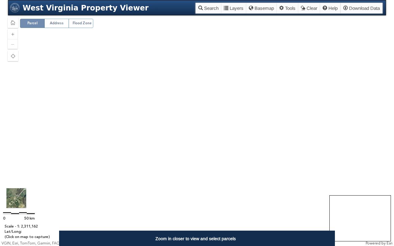
The detail panel is dynamic. Check the live card for any specific parcel.
Find a Putnam County Parcel Map by Address
Start with the current address or E-911 location. Then verify district and full parcel key. Check both against WV Property Assessment. Addresses can differ from historic deed descriptions after the county's 2014 readdressing work. A rural parcel without a street number takes a road name, tax district, map number, and deed description together.
- Open WV Property Viewer in parcel or address mode and locate the known road or E-911 address.
- Select the parcel and copy its visible identifier, owner, physical address, and description.
- Compare the selected tax map label with the Assessor’s Root Parcel ID and deeded acreage.
- Use flood or delinquent layers for context, then confirm title details with the Clerk.
- Parcel number
- The tax-map key used to identify a mapped tract.
- Plat
- A recorded map that names lots or a subdivision layout.
- Lot and block
- A platted description tied to a recorded map.
- Metes and bounds
- A written tract description using calls and adjoining features.
Putnam County Parcel Maps Keep Deeded Acres in Front
West Virginia's assessment FAQ puts deeded acreage ahead of calculated acreage when they differ. Calculated acres come from parcel geometry. They are an estimate, not legal acreage. A large gap should go to the Assessor with the deed or survey. Before a purchase, easement, or building decision, compare the recorded legal description and survey rather than trusting the more precise-looking map figure.
The map still earns its keep. It finds the tract and its neighbors. It cannot replace the Clerk's deed or plat. A recorded description can explain why the tax polygon and a survey line fail to align.
Putnam County Parcel Maps and GIS Downloads Show Change Since 1939
Aerial coverage runs deep. The county download catalog lists aerials from 1939, 1949, 1963, 1969, 1975, 1982, 1987, 1993, 1995, 1999, 2006, 2010, 2012, 2014, 2016, and 2018. It adds 2021 coverage as well. The catalog also groups parcel boundaries, parcel data and sales, addresses, roads, railroads, boundaries, water features, land use, and soils. Contours round out the set. The WV GIS Clearinghouse offers digital surface tax maps. It also provides GIS files free under the stated statewide policy.
Check a layer's year and metadata first. Historic aerials can show when a road or building appeared. Ownership or subdivision still needs a deed or plat. Soils and contours add land context. County GIS downloads are physical-history context, not a title record.
The Putnam County GIS downloads page lists every data group.
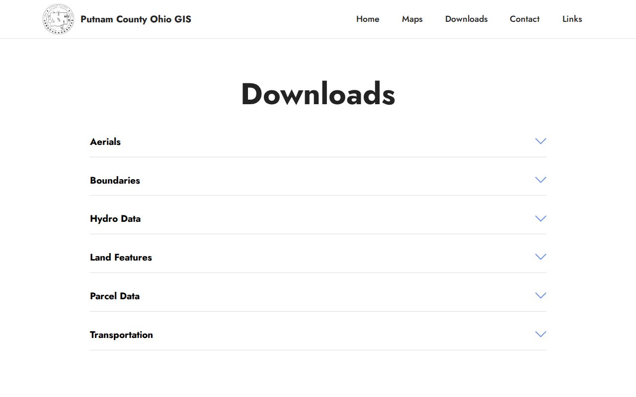
Use the catalog to compare years, then confirm ownership in the land record.
Putnam County Zoning Maps Are Reference Layers
The county Planning and Zoning Viewer is reference-only. It is not the official zoning map. County Planning covers unincorporated areas and selected county-zoned places, while municipalities with local land-use authority must be checked separately. The Teays Valley plan places Hurricane outside county planning authority, and Hurricane-area assessment results along the same road corridor include both 6-Hurricane Corp and 10-Scott District.
Zoning answers live at the city or county level. Ask the right city or County Planning office. Request the parcel's formal status and any governing map or ordinance. A postal city, ZIP, or colored GIS polygon is not the boundary record.
Putnam County Plats Stay With the County Clerk
The Assessor hands off plat requests to the County Clerk. Flood maps belong to Planning instead. Putnam County publishes a Clerk fee schedule that prices a plat copy at $5. A practical route starts with the legal description on the assessment. That description names the subdivision or tract. Take that name to the Clerk and search for a plat book and page. Then compare the lot and block against the deed. The county does not publish its plat-book naming rules or index coverage online.
Found a related transfer? The Putnam County deed records guide helps you trace its parties and legal description. A GIS map can orient you to the lot. Still, the filed plat and the deed remain the true record sources.
Putnam County Parcel Maps Use Six-Part IDs Across Three Systems
For plat maps, the Putnam County Assessor sends people elsewhere. Plats live with the County Clerk, and flood maps sit with Planning. The Clerk's published fee schedule charges $5 for a plat copy. A workable route starts with the legal description on the assessment. Pull the subdivision or tract name from it. Then search the Clerk's records for a plat book and page. Once there, compare the lot and block against the deed. The exact plat-book naming and how far the index reaches are not published online.
If the plat connects to a transfer, the Putnam County deed records guide can help. It shows how to trace its parties and legal description. The GIS map can orient you to the lot. Still, the filed plat and the deed remain the true record sources. For Putnam County property records questions, those documents come first.
Putnam County Parcel Maps in the State Viewer
A Putnam County parcel key has six parts: county, district, map, parcel prefix, suffix, and special ID. The county code is 40. Trouble starts because the systems trim the key differently. GIS may display a shorter identifier without the special ID. CAMA or IAS may drop the county code entirely. That is why a copied map label often fails to match the full Root Parcel ID on an assessment result.
Keep every segment when you write the key down. Zeros, letters, and decimal suffixes all matter. Use the assessor's exact key whenever you contact the Clerk or Assessor about a parcel number.
Sometimes a deed cites a different map reference. Do not force the new and old IDs to match. Compare the legal description and any parcel split or merge record instead. A subdivision, road change, or tax-map revision can spawn a new assessment key while the deed still describes the parent tract.
What Putnam County Parcel Maps Cannot Prove
The parcel lines in the WV Property Viewer are reference geometry built for tax purposes. They carry no legal weight. A GIS line cannot fix a boundary, guarantee deeded acreage, prove who owns an improvement, or settle a zoning question. Map acreage sometimes disagrees with the deed. When that happens, Putnam County's FAQ says the deeded acreage governs assessment. For any real boundary dispute, the deed and a licensed surveyor give the answer that counts.
Not a survey. Use Putnam County GIS to orient to a tract, then obtain a licensed survey before building or resolving a boundary dispute.