
How to Search Hurricane Property Records
Putnam County, not the city, keeps Hurricane property records. Begin at the WV Property Assessment search. Use it when you have an address, owner name, street, map or parcel number. Hurricane parcels sit in the district labeled 6-Hurricane Corp. Nearby land may fall under a different one, such as 10-Scott District. A Hurricane mailing address or the 25526 ZIP code alone proves nothing about jurisdiction. Never assume a city permit rule applies. Verify the district and parcel key on the assessor result first.
- Search the county assessment portal by street name or address. If results are broad, add an owner name or district and inspect the displayed county, district, map and parcel fields.
- Take the parcel clue to the Putnam County Clerk's land-record index and search the grantor or grantee names and the legal description. A deed connects the parties and transfer, while an assessment result is a tax-roll snapshot.
- Check the Sheriff Tax Division for the bill or payment record. The tax cycle changes on a schedule, so compare the bill year before matching it to a recent sale.
- Open the WV Property Viewer or county GIS map using the parcel ID; inspect adjoining parcels and map context without treating a drawn line as a survey.
- For construction or zoning history, contact Hurricane's building department. No searchable public permit-history lookup was verified during research.
Field-by-field help for the assessor search sits in the countywide Putnam County property search guide, and the parcel maps page covers the map link, GIS ID and acreage. Keep the address, district and parcel number together whenever you ask an office to confirm a result.
Where Hurricane Property Records Are Kept
The land records behind any Hurricane property search belong to Putnam County. The County Clerk records deeds, deeds of trust, liens, releases and plats. The Assessor maintains parcel details and assessed values. The Sheriff Tax Division handles tax bills, receipts and delinquent collections. County GIS supplies the map layers. Most of these offices sit in Winfield or work through county and state portals. Hurricane itself runs permit and planning review for city work. The full custodian contacts are in the countywide office directory on the home page. This page stays focused on Hurricane sources.
Putnam County Records (deeds, taxes, parcels)
The County Clerk, Assessor, Sheriff Tax Division and GIS hold separate pieces of the Hurricane property record.
Hurricane Permits & Zoning
City Hall, 3255 Teays Valley Road
Hurricane, WV 25526
304-562-5896
Hurricane Neighborhoods and Subdivisions in the Records
No official list of named Hurricane subdivision plats can be presented with confidence. The table below relies on confirmed search anchors instead. Treat them as orientation clues rather than plat names. For a particular lot's recorded description, the authority is the county index, the recorded subdivision plat, or the assessor parcel card. That card settles the question. Familiar place names add another wrinkle. A label like Teays Valley can span more than one taxing district. It never defines a legal boundary on its own.
| Neighborhood / Subdivision | Era | In the Records |
|---|---|---|
| Hurricane corporate district | District era not verified | Assessment district is 6-Hurricane Corp; confirm individual map and parcel. |
| Teays Valley Road corridor | Street-era history not verified | County sample results include this road; nearby parcels may carry different districts. |
| Scott District edge | Boundary date not verified | 10-Scott District appears in county records near the Hurricane search area. |
When a deed or tax map names a subdivision, copy the exact spelling into any Clerk request. Include the lot reference too. Do not swap in a nearby road or a marketing name. A good workflow starts with a county assessment search by address. It then uses the parcel key to open the matching GIS geometry. The Putnam County parcel map guide shows how to compare the recorded map description with GIS without mistaking the display for a boundary survey.
Hurricane Property Records and City Boundaries
A parcel can sit right beside Hurricane. It can still fall outside city services and permit review. That is why the incorporated boundary matters. County assessment results give you the district. A city-limit map or a direct answer from the city settles any boundary question. Never infer incorporation from a street address. Do not rely on a ZIP code, utility provider, or the word “Hurricane” on a mailing label. If a property was recently annexed, keep the annexation ordinance. Keep updated parcel information with the deed and tax records too.
Putnam County's 2025 public agenda listed annexation matters near City Park. Rooper Hollow and Teays Valley Tire also appeared. Those items show boundary administration in motion. They do not prove any specific nearby parcel was annexed. Match a legal description or parcel map to the final action. Only then rely on the change.
Hurricane Property Records Across ZIP Code 25526
The 25526 postal area exists for mail delivery. ZIP geography has nothing to do with municipal limits. A search for “Hurricane” can easily return property outside the city, and a parcel inside the city may carry a district and mailing form that hides the line. Population figures underline the point. The 2020 Census counted 6,961 Hurricane residents, and the 2024 estimate came in at 6,813. The Census incorporated-place table is a population source, though, not a parcel-level boundary record. Use it to separate the city as a government unit from the wider postal area. Then check the assessed district. Ask Hurricane officials whenever a permit or zoning rule turns on the line.
The Census table identifies incorporated places used for population context in West Virginia: view the Census incorporated-place table.
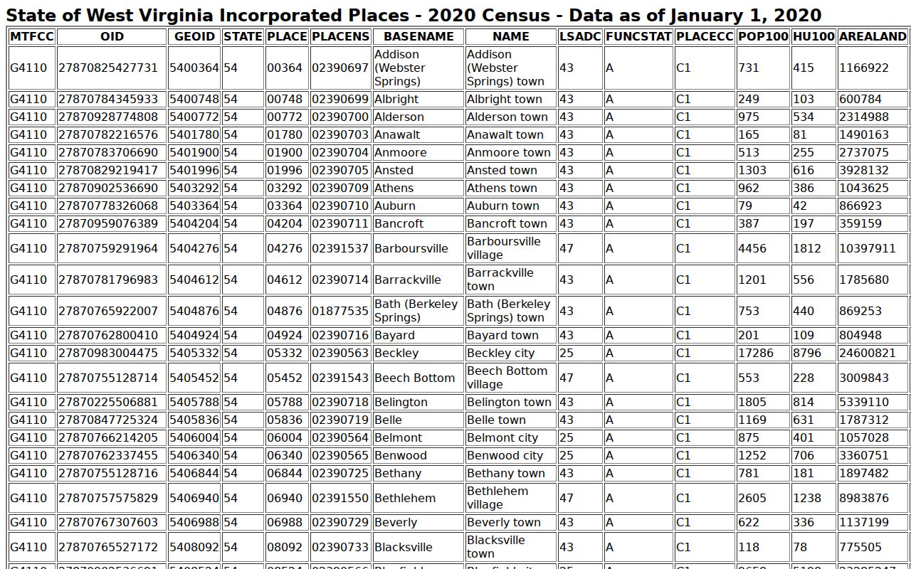
Demographic data only describes the city as a place. For a property-level decision, rely on county parcel and district records.
Hurricane Property Records Along Teays Valley Road
Teays Valley Road is a helpful address clue. But it crosses more than one assessor district. The county's Hurricane-area owner search returns LLC and road-address results. The examples include both 6-Hurricane Corp and 10-Scott District parcels. Start with the street. Then add a known owner or map number if the list runs long. Before opening a deed or GIS map, check each row's district, map and parcel. Similarly named owners may hold different tracts or be separate legal entities.
This county assessment query shows address and district fields for a Hurricane-area owner-name search: open the county assessment results.
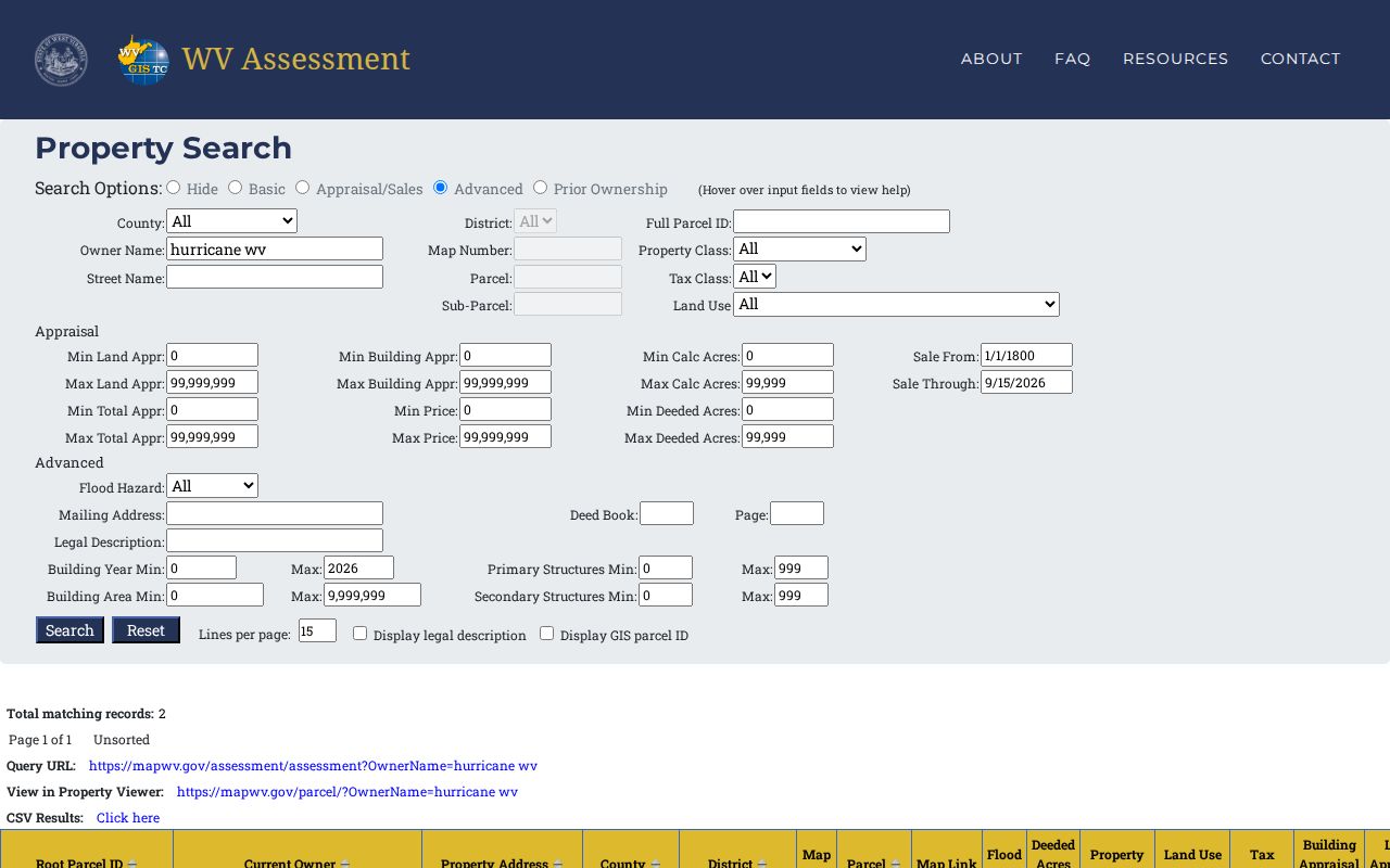
Always confirm in the current assessment portal. A saved view of a parcel search can go stale once the assessor updates the tax roll.
Hurricane Property Records and Permit Questions
Hurricane's Building Department handles building permits and plan review. Straightforward applications are often processed the same day. Work that needs utility or code review takes longer, and plan review typically runs about seven to ten business days. Treat those timelines as guidance from the city, not a guaranteed service deadline. Applications stay valid for six months. One free renewal is allowed before expiration. Inspection requests require 24 hours' notice, so schedule ahead before covering up finished work.
Permit applications go through City Hall or the building department contact. The county assessment search is not the permit route. The city publishes no address-searchable permit-history database. When you call, give the parcel number, the work type, and the approximate year. A missing online entry does not prove that no permit was issued.
Hurricane Property Records and Land-Use Decisions
Hurricane's permit materials separate zoning categories from planning decisions. A conditional use request asks whether a use allowed only with conditions may proceed at a site. A variance seeks relief from one specific zoning requirement instead. These are different questions. Collapsing both into a general "permit" search will muddy the record trail. For any parcel, ask the city for the application, staff report, hearing notice, final order, and any appeal record.
The city's variance appeal form carries a $100 fee. Fees and forms change, so confirm before filing. County parcel maps can orient you to the lot. City planning records still control the decision history, so bring the parcel ID and legal description when you contact staff so they can tell neighboring properties apart.
Hurricane Property Records and Assessed Value
Assessed value exists for taxation. It is not an asking price. It is also not an appraisal. West Virginia generally assesses property at 60 percent of fair market value or at a value established by law. A published ratio study measures groups of sales. It cannot prove the market value of one individual Hurricane home. Compare the parcel's building, land, and total appraisal fields against recent recorded transfers, property condition, and acreage. If the listed owner or address looks stale, review the deed and contact the Assessor. Don't assume the online row updates after a sale.
Hurricane Property Records in County Map Layers
County GIS layers and the statewide WV Property Viewer tie an assessor parcel to streets, aerial imagery. Flood data joins them in one place. The mapped acreage comes from drawn geometry. The deeded acreage in a recorded instrument carries more weight for title research. Historical aerials through Putnam GIS run from 1939 through 2021, with flights in 1949, 1963, 1969, 1975, 1982, 1987, 1993, 1995, 1999, 2006, 2010, 2012, 2014, 2016, and 2018. So Hurricane property records can be compared against decades of imagery. Older views may show clear land-use change over time. They cannot tell you when a structure was legally permitted.
The County lists its municipality information and points to local jurisdictions: see Putnam County municipalities.
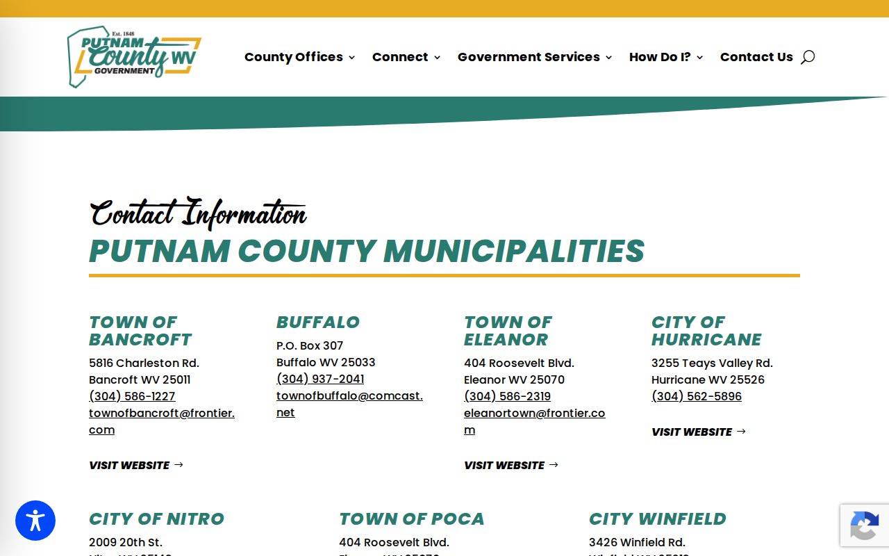
To pin down a specific address, pair the municipality roster with the city boundary and county district layers.
What Hurricane Property Records Show and Their Limits
Putnam County property records can show the assessed owner of record, the value, parcel dimensions used for tax administration, deed references, recorded liens, tax status, and mapped context. City files add permit applications or land-use decisions when the address sits inside Hurricane jurisdiction. Still, no single screen proves an unbroken title chain. None settles a surveyed boundary either. And none guarantees the legality of every improvement or today's market price. Confirm current ownership and the legal description in the recorded deed instruments themselves. Ask the relevant office about a missing permit record. Hire a licensed surveyor when a physical line matters.
Lawful use. Use Hurricane property records for property research, a transaction, tax review or civic transparency. Do not use owner information to threaten, stalk or harass anyone; West Virginia law prohibits threatening or harassing conduct.