
How to Search Putnam County Property Records
Match your starting point to the question. An address or owner name fits the WV Property Assessment Search. A parcel number is more exact. It travels well between the Assessor, GIS, Sheriff, and Clerk. For a deed or lien, use the recorded land index. The WV Property Viewer serves parcel and flood context. No single screen combines a title opinion, tax balance, permit history, and a surveyed boundary.
After a closing, check two things. Compare the assessment result with the newest recorded deed. The state site updates once a year. The tax roll freezes the name, address, and value on July 1 for the next tax year. A bill can still reach a former owner. For a full walkthrough of fields and modes, use the Putnam County property search guide.
- Search WV Property Assessment by Putnam County and street, current owner, or full parcel ID.
- Save the Root Parcel ID, district, map, parcel, deeded acres, and legal description from the result.
- Use that identifier to find the latest conveyance in the Putnam County Clerk land-record index.
- Check the Sheriff’s Tax Division for the bill and the WV Property Viewer for location, flood, or parcel context.
- Ask the named custodian for a copy or inspection when an image, permit, plat, or older book is not online.
Reading a Putnam County Property Record Result
A sample statewide search for Putnam records returns 111 rows across eight pages. One entry makes the pattern clear. The row for 3967 Teays Valley Road names the Putnam County Board of Education, identifies 6-Hurricane Corp, map 40 and parcel 70.0, and reports 11.41 deeded acres, with building and land appraisal amounts beside a total. One parcel, three angles. A public entity, a road address, and a corporation district can all describe the same parcel.
The result set offers CSV Results and pagination, and it is marked unsorted. The first page is not a ranked list. Rows carry no order of recency or importance. Some rows leave the property address blank. Others use a map sheet with a letter. Copy the full Root Parcel ID, plus the deed book and page or legal description, before moving to another system.
The county sample query supplies the row layout shown here: open the Putnam County result set.
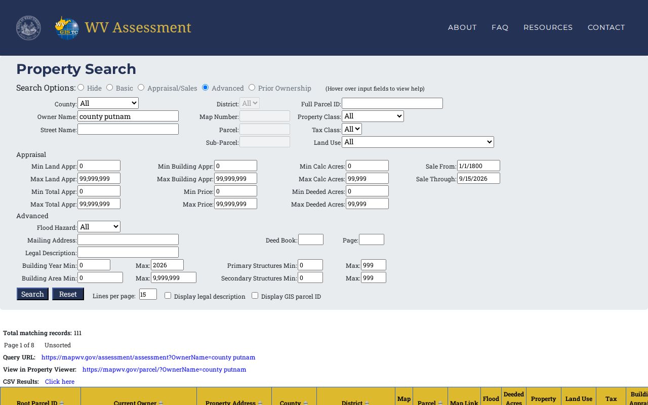
The screenshot helps you recognize each field. Then confirm the newest deed and tax status in the official records themselves.
Putnam County Property Records Link to the WV Viewer
The statewide viewer runs in parcel, address, and flood modes. Flood mode is the fastest route to flood context. Clicking a parcel can expose the E-911 address, owner and physical address, delinquent status, flood details, a parcel assessment report, building data, cost values, and appraised values. Highlight, copy-link, and Download KMZ controls keep the same location in view across steps. The viewer is a tax-reference tool, not a survey or an official zoning decision.
Putnam County GIS publishes parcel boundaries, sales, addresses, roads, railroads, hydrography, soils, contours, and other land features. The Planning and Zoning Viewer is reference only. Ask Planning for the formal zoning designation.
| Map detail | What it helps answer | What still needs checking |
|---|---|---|
| Parcel and address | Which mapped tax tract matches the street or E-911 location | Whether the line is a surveyed boundary |
| Owner and assessment link | Which roll entry is associated with the selected parcel | Whether a newer deed has been recorded |
| Flood information | Whether mapped effective or advisory zones touch the parcel | Insurance, engineering, and site-specific risk |
| Delinquent land | Whether the State Auditor-linked layer flags a parcel | Current certificate, redemption, or sale status |
| KMZ and highlight | How to save or share a map view | Legal acreage and title to the tract |
Putnam County Property Records in Historic Aerials
The GIS download catalog lists aerial imagery from 1939, 1949, 1963, 1969, 1975, 1982, 1987, 1993, 1995, 1999, 2006, 2010, 2012, 2014, 2016, 2018, and 2021. That run of years is a gift. A sequence shows when roads and subdivisions appeared. It can link an old address to today's map. Aerials cannot prove ownership or move a boundary, so match the visual clue to a deed description or recorded plat in the County Clerk index.
The authorized WV GIS Clearinghouse also publishes tax-map sheets and digital surface-tax files. Putnam's GIS site carries boundary, hydro, land-feature, parcel, sales, address, road, and rail layers. Check the dataset date and metadata before comparing years. Deeded acreage wins a conflict. The assessment FAQ gives it priority over calculated GIS acreage when the figures differ.
Putnam County's GIS download catalog is the source for the listed map datasets: open the GIS downloads page.
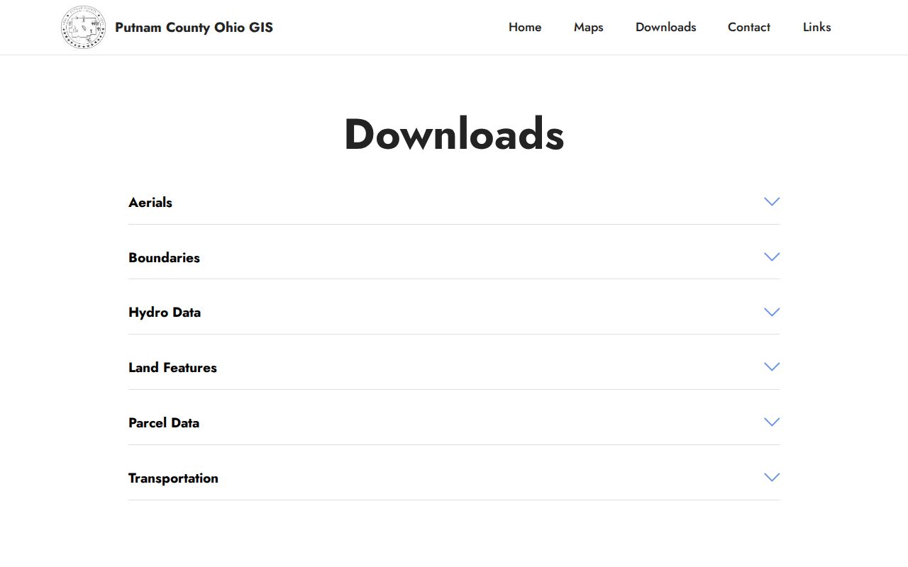
Use the aerial series for house and road history. For the parcel itself, seek a recorded legal description.
Putnam County Property Records Cross Permit Boundaries
Teays Valley shows why a mailing label is not a government boundary. County planning material describes a sewered growth area. It also notes Hurricane sits outside county planning authority. Assessor examples on Teays Valley Road fall in both 6-Hurricane Corp and 10-Scott District, so check the district and the current municipal record before deciding which office holds a permit or zoning file.
Hurricane's permit office handles city building and zoning work. The Clerk and Assessor hold the rest. See the Hurricane property records guide for annexation clues, the 25526 ZIP limits, and the city permit procedure. Nitro is a second special case. The incorporated city spans Putnam and Kanawha counties, so retain the county code from the assessment result.
West Virginia FOIA for Putnam County Property Records
West Virginia Code chapter 29B gives anyone the right to inspect or copy a public record. The right applies unless a specific exemption blocks it. Under §29B-1-3, send the request to the custodian and describe the record with reasonable specificity. The custodian must respond within five days, not counting weekends and legal holidays. The reply can supply copies or arrange an inspection. It can also deny the request in writing with reasons and review information. Fees can cover actual reproduction cost only. The statute bars search, retrieval, and hourly labor charges.
A focused FOIA request works best for Putnam County property records. Name the parcel, the old and current address, the owner or entity, the document type, and a date range. Ask for an electronic copy when the office already holds the record in that form. A request can reach a permit file. It can also reach an older plat that is not indexed online. It cannot force an office to build a new summary or database.
WVPASS Adds Putnam County Property Records Litigation
West Virginia’s statewide Court Record Access page covers circuit records for all 55 counties. It also covers magistrate records. The 2025 WVPASS launch notice says public circuit documents go back to 1999. Registered searching is free. Public document downloads cost 25 cents per page plus card processing. Confirm the current price before ordering. A foreclosure judgment, quiet-title case, partition, or lien lawsuit can explain a property dispute. But the deed, trustee report, or release still lives in the County Clerk’s land record.
Family, juvenile, adoption, sealed, and expunged material carries separate limits. For documents not online, contact the Circuit Clerk with party names. Include the case number if known. Also give the property description and the document type. A clerk can arrange inspection during business hours. The clerk is not required to read a file over the phone. Nor must the clerk prepare a new summary.
State Auditor Extends the Putnam County Property Records Tax Trail
When property in Putnam County is delinquent, the paper trail spreads across three places. The same goes for parcels certified to the state. Check the Sheriff’s tax records. Check the WV State Auditor’s County Collections system. Check the delinquent-land layer in the GIS viewer. The State Auditor search accepts many fields. They include tax year, county, district, map, and parcel. The list also covers subparcel, certificate, taxpayer, purchaser, and bidder. Description, ticket, account, and status round it out. A separate deputy-land section lists deed book and page. The viewer FAQ says the delinquent layer updates weekly.
State guidance gives owners roughly eighteen months to redeem before auction. The specific certificate and tax year still control the next step. Do not rely on an old tax bill or a map flag alone. Confirm the tax year with the State Auditor or the Sheriff. Also confirm the certificate, sale notice, and redemption status.
The state collection portal lists certified-land search fields: open State Auditor County Collections.
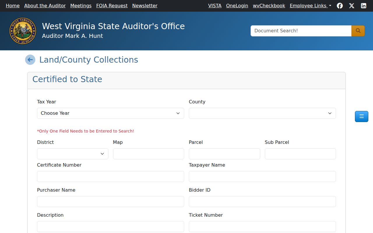
This interface is a separate delinquent-land path, not the ordinary yearly tax-bill lookup.
Putnam County Property Records and LLC Owner Names
An assessment row for Putnam County property records may list a development company, trust, estate, or public body as the Current Owner. Copy the name exactly. Match the punctuation and word order, too. The West Virginia Secretary of State’s Business Organization Search supports Organization, Agent/Officer/Name, and Record ID fields. Optional street, county, state, and industry choices narrow it further. Results can reveal the entity, its registered agent, and its filing address. They do not prove the entity owns a specific parcel.
The recorded deed and legal description make that connection. A Hurricane-area query shows why. LLC names appear on Teays Valley Road. They also appear in both Hurricane Corp and Scott District. Entity name, mailing address, district, and city label are distinct clues in a parcel search. Reset the SOS search between queries, because advanced selections can persist.
- Grantor
- The party conveying an interest in a recorded instrument.
- Grantee
- The party receiving the interest named in the instrument.
- Parcel ID
- The tax-map key that connects assessment and GIS records; formats can vary by system.
- Assessed value
- The tax-side figure carried by the assessment roll, not a sale appraisal.
- Plat
- A recorded map of lots and related survey or subdivision information.
Putnam County Property Records Offices
Four county offices handle most property questions in Putnam County. The County Clerk records deeds and plats. The Assessor maintains parcel and tax attributes. The Sheriff’s Tax Division answers tax bill and payment questions. Planning & Infrastructure holds county land-use files where county authority applies. Municipal permit offices stay separate from title records. They also stay separate from assessment records.
Putnam County Assessor
Putnam County Courthouse
Winfield, WV 25213
304-586-0206
Putnam County Sheriff Tax Division
236 Courthouse Drive, Suite 8
Winfield, WV 25213
304-586-0204
RECORDhub Is the Putnam County Property Records Index
The Putnam County Clerk moved from the legacy West Virginia County Clerk Portal. The new home is Cott Systems RECORDhub. Start at the current gateway for indexed deeds, deeds of trust, liens, plats, releases, and trustee reports. Guest index access and image access are separate under the transition notice. An index hit does not guarantee a full document image. The county pages publish no earliest online year or exact image coverage for Putnam.
The Clerk’s fee chart gives a local copy baseline. Ordinary copies cost $1.50 for the first two pages and $1 for each added page. Certification adds $1. A plat copy runs $5. Portal charges may differ, and old subscription details may no longer apply. Before ordering, capture a document number or book and page. Then ask the Clerk to confirm the current access and copy route.
The RECORDhub gateway is the entry point. A populated Putnam result does not always appear there. For an image or year that is not searchable online, the record room or a written request is the fallback.
July 1 Shapes Putnam County Property Tax Records
Putnam County builds its property tax records around July 1. That date freezes the assessment value, the name, and the mailing address. Those details then appear on the coming tax bill. The Sheriff's Tax Division mails bills on July 15. If yours has not shown up by July 25, the office asks you to call. One quirk catches new buyers: record a deed after the freeze. The seller's name can still sit on that year's bill.
A tax bill has a narrow job. It shows the tax year, the account or ticket, the amount, and payment status. Nothing more appears on it. For the current owner of record, the deed records at the recorder come first, not the bill. The published receipt lookup accepts a taxpayer name, account number, ticket number, or parcel ID as search keys. The division sits at 236 Courthouse Drive, Suite 8, in Winfield. It is open Monday through Friday, 8 a.m. to 4 p.m.
Putnam County's Tax Division page provides the dates and office contact information summarized above: view the Tax Division source.
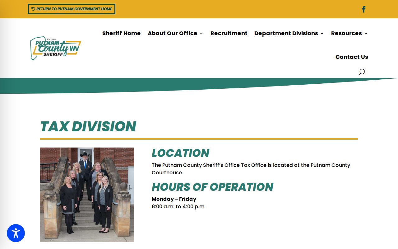
Whenever a transfer falls near July 1, read the bill's name and date beside the most recent deed on file with the Clerk.
Putnam County Property Records Search Starts With the Parcel Key
The Putnam County assessment search offers Basic, Appraisal/Sales, Advanced, and Prior Ownership modes. Start with the county and district selectors to narrow your property search. Then hold onto the exact parcel key it returns. The table gathers the fields that matter most. Expanded modes add appraisal, building, sale, and display controls for deeper digging.
| Portal field | Use in a Putnam search | Limit to keep in mind |
|---|---|---|
| County and District | Choose Putnam, then a corporation or rural district such as Hurricane Corp or Scott District | A postal city name does not prove the district |
| Full Parcel ID | Match the same tract across assessment, GIS, and land records | Formats may shorten or omit leading zeroes |
| Owner Name | Find parcels indexed to a person, trust, estate, or LLC | Spelling and punctuation vary; confirm by deed |
| Street Name / Mailing Address | Find a situs road or a separate tax-mailing route | Rural parcels can lack a street address |
| Map Number / Parcel / Sub-Parcel | Use a paper tax map or partial identifier | Map numbers may include letters or suffixes |
| Deed Book / Page and Legal Description | Bridge an assessment result to the County Clerk index | Verify the referenced instrument in the Clerk record |
| Appraisal and acreage ranges | Narrow a valuation or land-size query in expanded modes | Calculated acres are not deeded acres |
| Building, sale, flood, and display controls | Refine an Appraisal/Sales query or add legal description / GIS ID | Some dropdown options and price meanings are not fully exposed |
Deeper filters cover property class, tax class, land use, deed book and page, legal description, building year, sale date, acreage, flood hazard, and minimum or maximum appraisal ranges. Open the official WV Property Assessment Search to use the current form.
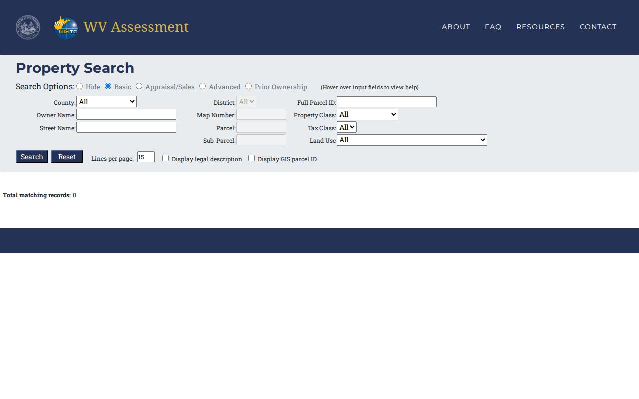
Portal labels and filters may change over time, so the copied parcel ID remains the safest key for any later lookup.
Types of Putnam County Property Records
Different Putnam County property records answer different questions. A tax parcel can point to the owner carried on the assessment roll. A deed names the parties to a transfer. A plat decodes lot and block, while a court docket can reveal a filed dispute. Read each record for its own purpose. Use the parcel ID to tie the systems together.
| Record Type | What It Documents | Kept By | Access |
|---|---|---|---|
| Deeds and land instruments | Transfers, easements, liens, releases, and recorded legal descriptions | Putnam County Clerk | RECORDhub index; image and copy access varies |
| Assessment and tax | Owner field, parcel class, appraisal, bills, and payment records | Assessor and Sheriff Tax Division | State search, tax lookup, and counter request |
| Maps and plats | Tax-map geometry, lot context, flood and address links | WV Viewer, GIS, Clerk, Planning | Viewer/downloads; Clerk plat copies |
| Court and estate files | Foreclosure, quiet title, probate, fiduciary, and case activity | WV Judiciary, Circuit Clerk, Fiduciary | WVPASS, clerk inspection, or county request |
| Permits and zoning | Construction, inspection, land use, subdivision, and local code matters | City department or County Planning | Ask the authority for the parcel |
Match the record to the question. Title history lives in the land index. Delinquency belongs to the Sheriff and the State Auditor. Assessed value sits in the assessment result, while consideration ties to a deed instrument. The County Clerk's recording list goes well beyond warranty deeds, covering living trusts, mechanic's liens, statutory liens, lis pendens, right-of-way documents, substitute trustees, and plat maps.
What Putnam County Property Records Can and Cannot Tell You
Putnam County property records can document an owner of record as of a record date. They can show an assessed value, tax status, recorded transfers, liens, and parcel map references. They cannot promise that every instrument is indexed. They cannot promise that a mapped line is surveyed, or that an appraisal equals a likely sale price. The records come from different offices and update on different cycles. For a title conclusion, review the deed chain with a title professional. For a boundary, hire a licensed surveyor. For value, compare current sales and property condition. Treat every online result as a clue worth checking with the custodian.
Lawful use. Property records support ownership research, transaction due diligence, tax review and public accountability. A search is not a title opinion or survey. Do not use information about an owner to stalk, threaten or harass anyone; threatening or harassing conduct is prohibited under West Virginia law.